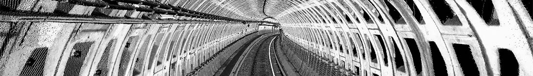
Our MoSES (Mobile Mapping System) enables the exact recording of tunnel sections and underground railway networks by kinematic surveying with several 3D high-performance laser scanners and high-resolution infrared cameras. Due to the flexible arrangement of the cameras and the laser scanners, every tunnel can be captured seamlessly.
In addition to the evaluation of the high-resolution laser scanner measurement data, orthophotos of the surface form the basis of the data evaluation.
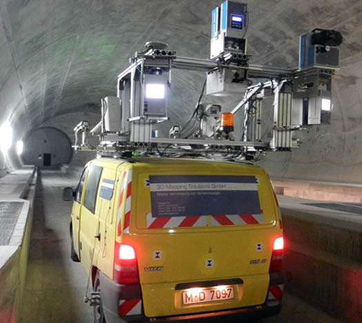
(courtesy of AlpTransit Gotthard AG)
The high resolution of the laser scanners and camera data in combination with high-precision inertial measurement technology enables cross-sectional analyses, in particular extraction of the rail course, analyses of the rail itself and structural cross-sectional analyses, in particular clearance analyses, due to the relative accuracy in the range of a few millimeter (< 5mm) even without the use of control points.
The clearance gauge is a defined boundary line that is usually defined for the vertical transverse plane of a track (e.g. of roads or railway tracks). On the one hand, the clearance gauge specifies the "clear space" that must be kept clear of objects on the track. On the other hand, it also serves as a design specification for the dimensioning of the intended vehicles.
3D Mapping Solutions has many years of know-how to carry out these analyses for our customers.
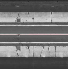
The measurement technology of our Mobile Mapping System (MoSES) enables the metrically exact mapping of the roadway or tunnel as an orthophoto. These can be generated from scanner data (maximum resolution 5x5mm pixel size) as well as from camera data (maximum resolution 1x1mm pixel size).