Problem statement
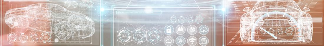
Automated and connected driving (AVF) holds the potential of a so-called "game changer" for the mobility of the future. In the public perception, development is taking place almost exclusively in the USA, even though the world's leading vehicle manufacturers, technology suppliers and scientists are based in Germany - why? The answer lies, among other things, in the agile development processes and virtual development methods of the American IT industry, which has now chosen mobility as its target industry and views autonomous means of transportation as rolling computers. This contrasts with the traditional development processes and validation methods of the German automotive industry, which focuses on the usability and functional safety of its products and validates them primarily by means of real-life driving tests. The present joint project aims to integrate the advantages of both development perspectives and to advance new methods and processes for a rapid and, above all, efficient and safe introduction of AVF.
Project objective
SAVe:' generates a basis for the development of automated and connected driving (AVF), especially in urban environments, taking into account the interaction with social issues. The methodical development of combined virtual and physical validation of traffic scenarios, especially in mixed traffic and in urban environments, creates an overall basis for future vehicle and traffic infrastructure developments. To this end, the partners in the "SAVe:" project submitted here are initially aiming to digitize exemplary sections of road in the city of Ingolstadt, on the basis of which the virtual development and implementation process for new AVF functions and components will be based.
Realization
The exemplary route sections to be depicted in the model address both the digital test field of the highway and the digital test field of the city. The modeling of the necessary technical components in a simulation environment as well as the actual simulation of functions of the AVF in exemplary realistic driving scenarios are of trend-setting importance for their future validation and thus a safe introduction. The simulation scenarios are enriched and validated by linking them to real-world tests and using fleet data. The combination of virtual and digital test field offers the possibility to create a secured development environment for AVF. For this purpose, scenarios are developed in the project, which are evaluated with regard to their acceptance on the basis of demonstrators with the participation of citizens.
Tasks 3D Mapping Solutions
The exemplary data model specifies how the relevant information is to be represented. This includes the clarification of the model, the structure, the connection, as well as the access to the information. The data format of the base map will contain classic elements of a road database, such as the effective storage of the reference axes in routing parameters or splines, markings, parking spaces, crosswalks, traffic lights, etc.. However, the base map will also contain elements from the driving simulation, such as information on the logical linkage of lanes, turning elations, intersection models, traffic lights, etc. In addition to the requirements for an as-built map from engineering surveying or a reference map from automotive development, a suitable connection for 3D visualization, e.g. in CityGML, will also be found.
Possible use cases are the application of the reference map for example in traffic planning, in urban applications, e.g. construction planning, as a basis for simulation, as well as a basis for the calculation of environmental impacts.
A test area in Ingolstadt is now planned as a demonstrator, in which the requirements from the work packages can be tested. The test areas will be selected inner city areas in order to cover as many use cases as possible. The test areas will be driven over and measured with laser scanners. After evaluation and modeling of the data, a high-resolution, high-precision reference map will be available as an as-built map of the environment with all logical links.
Project duration
06/2018 – 06/2020
Project website