Problem statement
When it comes to the future of connected and automated driving, research often focuses on technical developments in vehicles and infrastructure. Less attention has been paid to the users of these new technologies and the other road users involved. Will people in the future simply get into self-driving vehicles and be driven around with confidence? And how will other traffic participants, such as pedestrians, cyclists and non-networked automated drivers, interact with these state-of-the-art vehicles? These questions are now being investigated by traffic psychologists and traffic engineers from the Faculty of Traffic Sciences "Friedrich List" at the TU Dresden over the next 30 months in the TEMPUS research project.
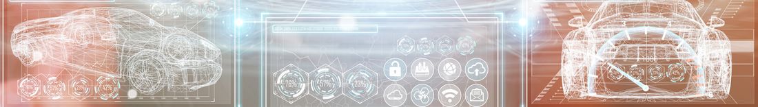
TEMPUS stands for "Test Field Munich - Pilot Test Urban Automated Road Traffic". For this purpose, a test field for automated and connected driving will be established in the north of the Bavarian capital Munich. An important milestone will be the actual use of automated vehicles in summer 2022. This will be preceded by a large number of technical developments and implementations in the coming months.
Project objective
The aim of the project is to enable new forms of mobility in an urban context, thereby increasing and improving traffic safety and traffic flow for road users. To this end, the traffic infrastructure in the north of Munich is being converted and upgraded, among other things with "smart" road traffic technology and communicating traffic signals.
The scientists at the Institute for Traffic Planning and Road Traffic, which is part of the Dresden Institute of Transportation Sciences, with the participating professorships for traffic psychology and integrated traffic planning and road traffic technology, are focusing on people. Under the direction of Dr. Jens Schade, they are investigating which conditions must be met by various target groups for them to accept automated vehicles. In addition, the Dresden traffic psychologists and engineers are investigating the interaction between non-networked and automated-networked road users.
Realization
Previous studies on communication and interaction with autonomous vehicles mostly assume a healthy, adult human as the interaction partner:in the new technology. The requirements of particularly vulnerable social groups, such as children and older people or people with limited mobility, for future intelligent transportation systems have been largely ignored. The question of how citizens envision future intelligent transportation systems and how autonomous vehicles can be integrated into urban traffic from their point of view has also remained largely unanswered.
The Dresden researchers are now investigating these questions in more detail using various methods such as surveys, focus group discussions and workshops as well as on-site observations and interviews.
Tasks 3D Mapping Solutions
At the beginning of the project, 3D Mapping digitizes the test area in the north of Munich with mobile mapping systems and participates in the agreement of the requirements and interfaces in the TEMPUS project consortium. The basis for the creation of the highly accurate base map is, in addition to the data acquisition, the evaluation of the adoption of existing map bases from the city of Munich and the adoption of existing, highly accurate reference maps (ultra HD Maps) for autonomous driving for parts of the test area from BMW AG. The existing ultra HD maps will be updated and brought up to date by 3D Mapping. All required objects are extracted from the base data recorded by 3D Mapping. As a basis for the TEMPUS project, a highly accurate base map is created, which contains all objects (lanes, markings, curbs, signs, etc.), but also elements from the driving simulation, such as information about the logical linking of lanes, turning relations, intersection models, traffic lights, etc.. The highly accurate reference map forms the basis for the work of the other project partners, especially for the field tests and traffic simulation.
In the course of the project, the requirements for the interfaces and the map contents have to be coordinated. For the TEMPUS project, the dynamic map contents (traffic lights / variable message signs) for the traffic simulation are of particular interest. High demands are placed on the transfer of the traffic light circuits and, if necessary, their export into corresponding control documents. The transfer and efficient updating of existing map data, especially for inner city map data, is new. Suitable processes and fundamentals are to be evaluated by 3D Mapping and put into practice.
The task of providing a digital map specifically adapted to the requirements of urban traffic simulation and local public transport is new and the basics are to be developed by 3D Mapping.
There is a great need for research especially with regard to the map bases (content / accuracy) and with regard to the dynamic objects, especially traffic lights, which are not yet sufficiently defined either in the map bases or in the associated scenarios. The maps are provided in OpenDRIVE, suitable for the simulation tools used. Exports in other data formats for parts of the objects or specifically for the intersections and traffic light circuits will be agreed upon within the project. In the 3D mapping process chain for the export of the highly accurate map data, adaptations for the TEMPUS project are necessary and will be made accordingly. Various bases, objects and the dynamic objects are new territory for the data export formats and will be implemented via user-defined specifications if necessary.
In addition, 3D Mapping evaluates the use of existing, current geo-base data of the city of Munich for the creation of highly accurate map data for autonomous driving. For this application, the basics, criteria and processes are to be developed in the course of the project. The range of detail and possible interpretations for high-accuracy maps is very wide. The possibilities of using the geo-base data of the city of Munich to create highly accurate map data for the TEMPUS project are to be evaluated by 3D Mapping.
Project duration
01/2021 – 06/2023
Project website