

Problem statement
Previous research projects have addressed systems for partial automation in which the driver must continuously monitor the system. monitor the system. Highly automated systems, on the other hand, offer significantly greater benefits, since they can take over the driver's
can take over the driver's task completely for much longer. Further automation promises to increase road safety and comfort.
and comfort.
Project objective
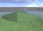
The aim of the Ko-HAF research initiative is to develop cooperative, highly automated driving for higher speed ranges (up to 130km/h) on well-developed traffic infrastructure. Highly automated driving means that the driver no longer has to driver no longer has to perform the driving task permanently, but must be able to control the vehicle at any time on request with a control of the vehicle at any time with a certain time reserve.
Realization
In addition to automating the longitudinal and lateral guidance of the vehicles, the project aims to significantly improve the foresight for environment detection. will be significantly improved. The basis for this is the development of a highly updatable and accurate digital map, which is made available by means of a cooperative back-end solution, provided by a cooperative back-end solution. Since the driver cannot yet be completely removed from the control loop, the return of the driving task to the human driver within a certain time reserve is also being researched. In addition to virtual tests, several test vehicles are being set up for testing and demonstration purposes. The novel driving operation will be used on test sites and in public road traffic.
Tasks 3D Mapping Solutions
The task of 3D Mapping Solutions was to survey and provide highly accurate base data model of the test track. Furthermore, procedures for updating the map and for quality determination were to be developed.
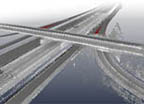
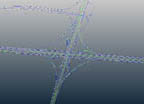
In the joint project Ko-HAF, 3D Mapping Solutions created a high-resolution reference map in OpenDRIVE® format as a data basis. Using the Mobile Road Acquisition System, 3D Mapping Solutions scanned the A3, BAB661, A5, BAB66, BAB648 highways (see Figure 5), evaluated the data and extracted lane geometries and objects. Subsequently, the traffic network logic was mapped in the internal CAD. For the collaborative project, 216 km of lane axes were modeled, 3395 signals, 6138 point objects, 356 line objects, and 286 intersections were mapped. The semi-automated object extraction makes a relative accuracy of 1-3 cm for road markings or objects possible. In addition to 14 different lane types, 3D Mapping Solutions modeled the traffic network through 18 different object types and all traffic signs according to StVO.
Project duration
06/2015 – 11/2018
Project website
www.ko-haf.de