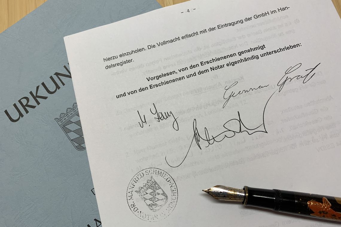
Dr.-Ing. Gunnar Gräfe and Dipl.-Ing. Martin Lang jointly found 3D Mapping Solutions GmbH on February 15, 2007. Emerging from the working group "Integrated Kinematic Surveying (IkV)" at the University of the Federal Armed Forces (FAF) Munich, the two-man company starts its success story with one kinematic multisensor surveying system.
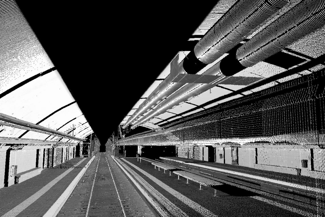
Our MoSES measurement vehicle enables the exact recording of tunnel sections and subway networks through kinematic measurement with several 3D high-performance laser scanners and high-resolution infrared cameras. Thus, the tunnels of 6 lines, including the intersections of the metro in Barcelona, as well as the access roads to the depots are recorded without gaps with the help of the flexible arrangement of the cameras and the laser scanners. 3D Mapping Solutions provides an overall documentation of the infrastructure of the metro lines for a total of almost 90 km.
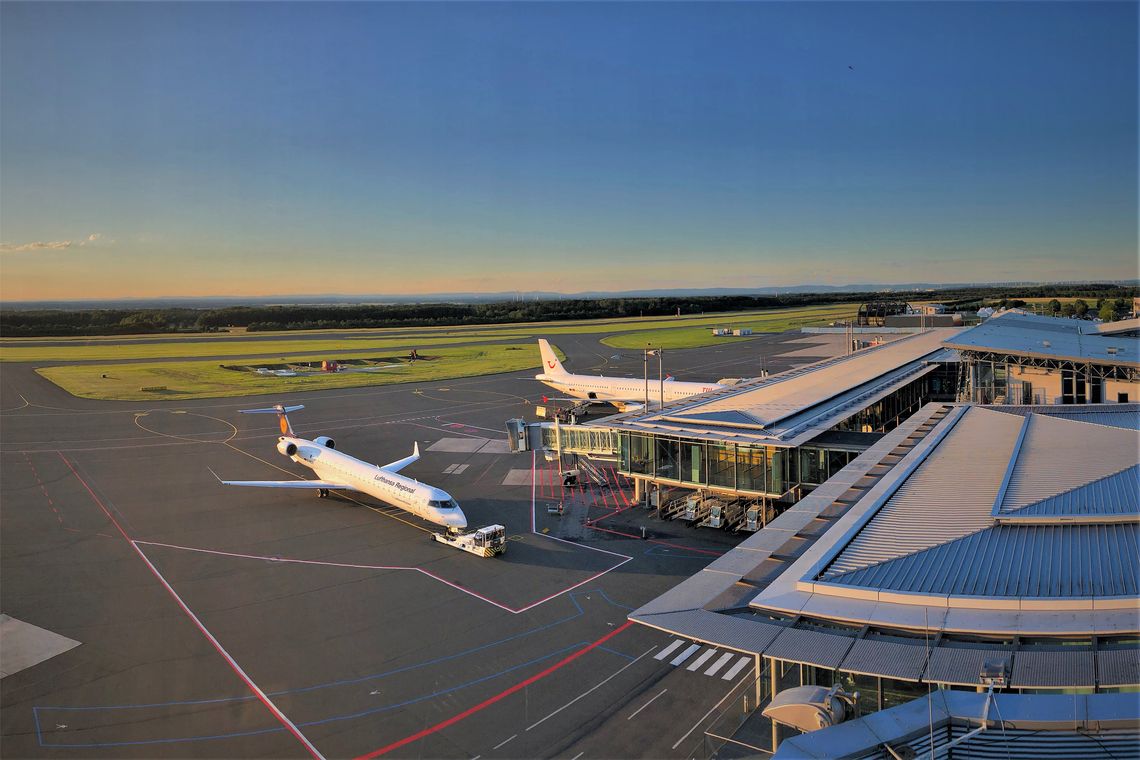
Decades of use and the associated stress on the asphalt, makes the renewal of the pavement of the airfield at the Airport Paderborn-Lippstadt inevitable. Therefore, 3D Mapping Solutions creates a surface model with a 10x10 cm resolution of the nearly 2,600 m runway and its access roads as a basis for planning. The extraction of the runway edges, markings, fire, slot gutters and other accessories from the point cloud is also necessary for the subsequent rehabilitation of the 120,000 m² area.
Oberhaching is planning the construction of a district heating network and commissions 3D Mapping Solutions to survey the entire street area of the community. As a basis for the geothermal planning, it is necessary to prepare the mobile mapping data as an as-built map on a large scale for the first time. We still use as-built maps in an extended form as the basis for all kinds of mapping projects.
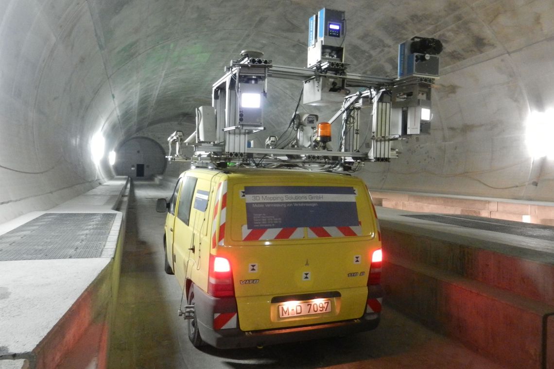
As part of the building inspection of the Gotthard Base Tunnel, 3D Mapping Solutions is involved in the audit concept. On site, our engineers and technicians measure the completed tunnel tubes and use a new type of scanner that generates a much greater point density with higher individual point accuracy at the same time. Based on this, we can check the cross-section of the tunnel and answer the question of whether construction has been carried out in accordance with the requirements within the permissible tolerance, so that safe passage of all vehicles is possible later on.
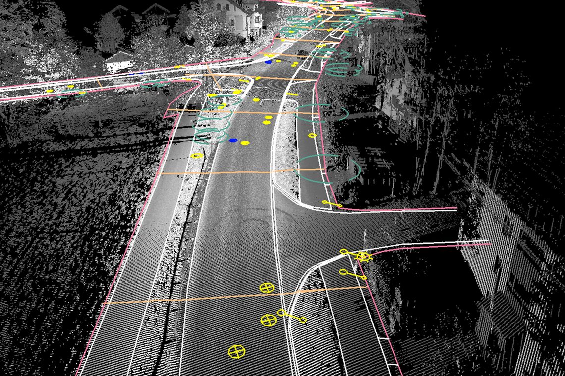
DLR needs support for a top-class task: creating an exact three-dimensional image of a city. It quickly becomes clear that piecing together the streets using remote sensing data is not sufficient. In the course of this, 3D Mapping Solutions implements the very first OpenDRIVE® project in the company's history. After one year of development and production, 20 km of Braunschweig city centre are exported as a highly intelligent map in OpenDRIVE®. This project includes some of the most complex intersection layouts.
3D Mapping Solutions is contracted to survey the Levi ski resort in Finland. The detailed results are supposed to enable more efficient snow farming in the coming years, so that natural snow can be wintered much better and used the following year. For the survey we mount a scanner, the IMU and the GPS system to a helicopter. Within five hours, two survey flights are completed and 25 km of slope, including buildings, lift poles, lighting facilities and snow cannons are recorded. After the good results of this survey, 3D Mapping Solutions is also entrusted with the survey of the ski resort Les Saisies in France.

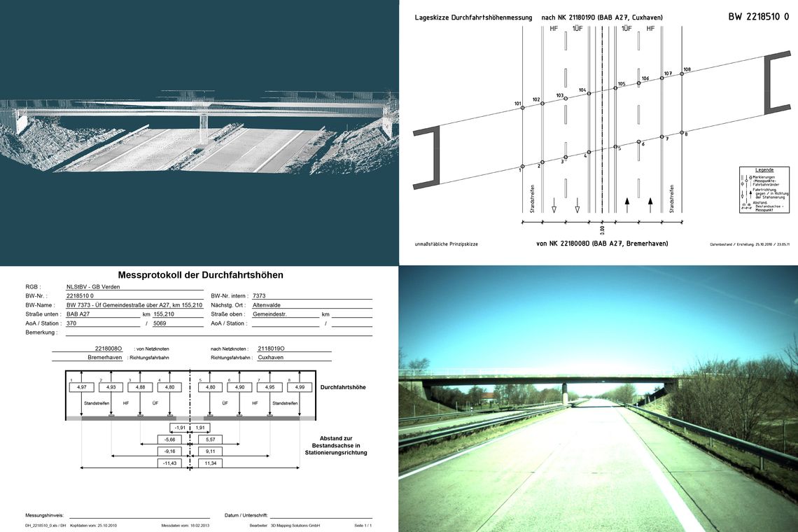
Who would have thought that Lower Saxony has 3,778 bridges on highways and federal roads?
To ensure that heavy transports can pass them without danger, 3D Mapping Solutions is commissioned to determine their clearance. For this purpose, about 25,000 km of highways and main roads are surveyed on approximately 80 survey days and each individual bridge is precisely charted.
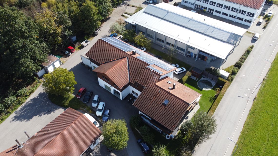
Within seven years 3D Mapping Solutions has successfully grown to 15 employees and now needs more space than the Oberhaching location is offering. In March not only the colleagues move into a beautiful new office in Holzkirchen, but also the two surveying vehicles with their sensitive measurement technology into a secure garage. The relocation is part of the long-term strategy and a prerequisite for the current and future growth.
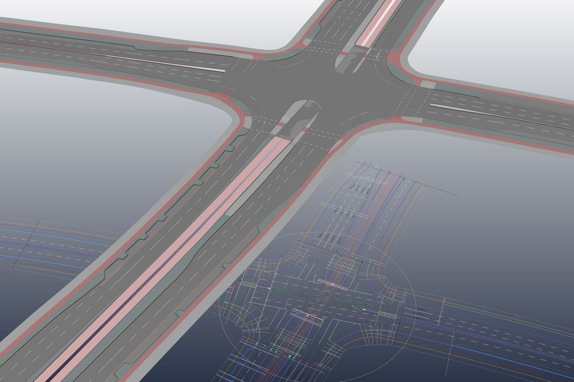
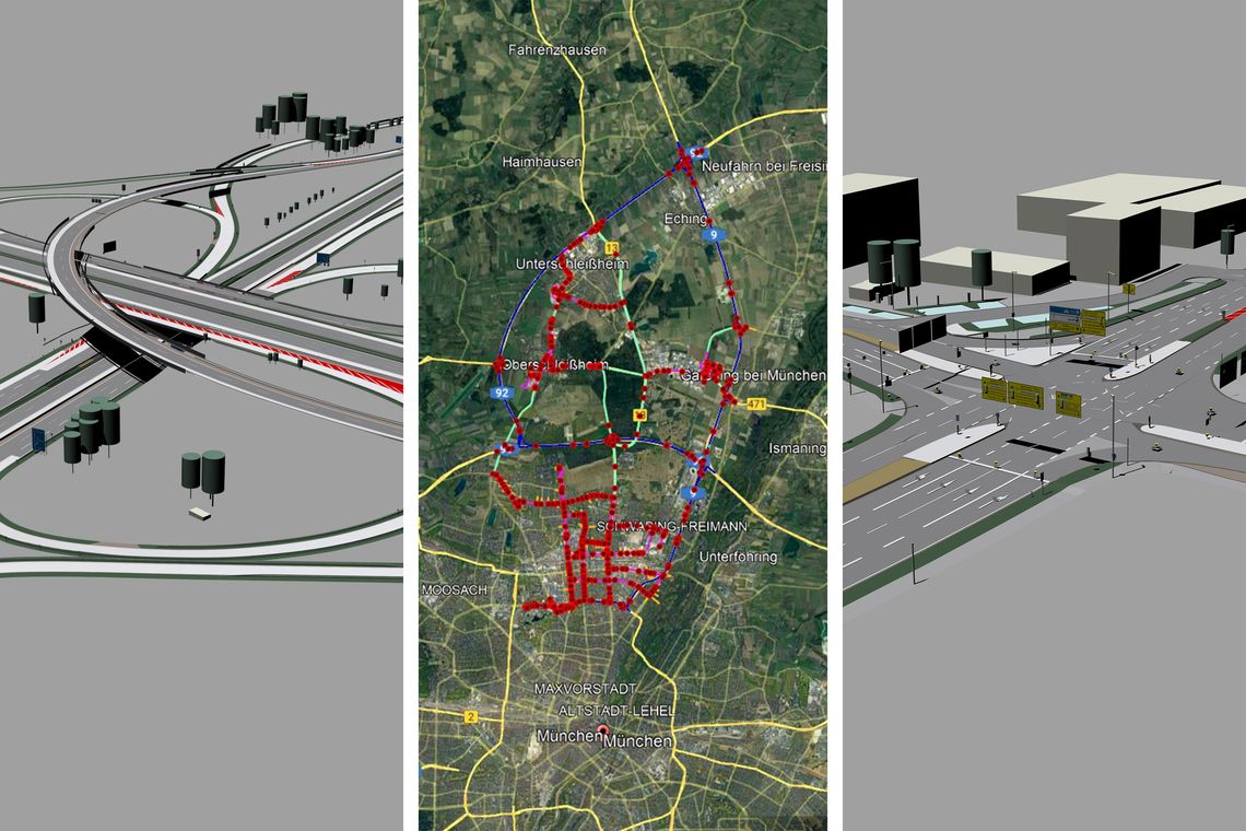
In the joint research project Ko-HAF 3D Mapping Solutions creates a high-resolution reference map in OpenDRIVE® format as a data basis. With our surveing vehicle we scan the A3, BAB661, A5, BAB66, BAB648 highways in Germany, evaluate the data and extract lane geometries and objects. Subsequently, the traffic network logic is integrated in the internal CAD. For this research project, 216 km of lane axes are modeled, 3,395 signals, 6,138 point objects, 356 line objects and 286 intersections are mapped. Semi-automated object extraction enables a relative accuracy of 1-3 cm for road markings and other objects. In addition to 14 various lane types, 3D Mapping Solutions is maps the traffic network through 18 different object types and all traffic signs according to the German Road Traffic Act (StVO).
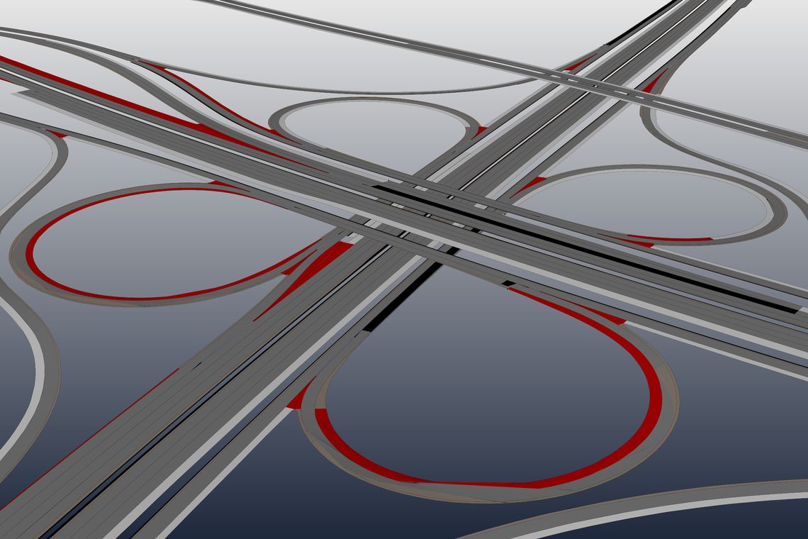
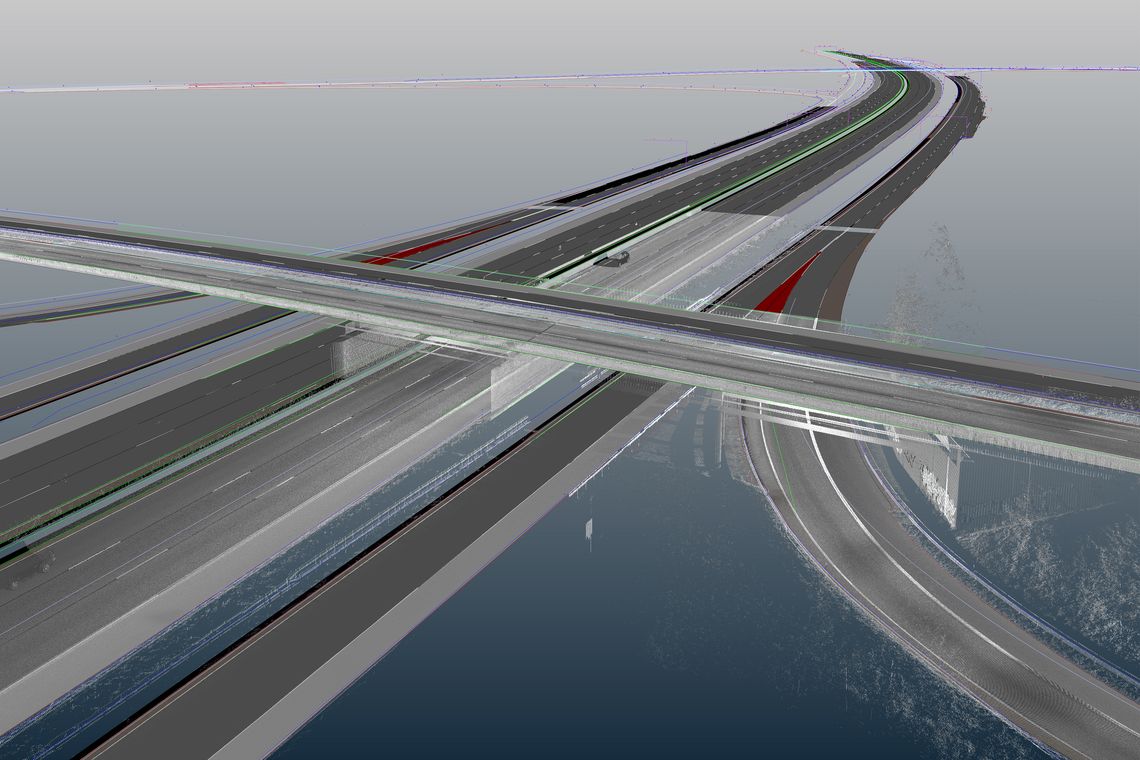
The research initiative PEGASUS aims at defining a standardized procedure as well as developing appropriate tools for testing highly automated driving functions using the example application of the highway chauffeur. In particular, this is intended to prepare the release of highly-automated vehicles for the market. For this purpose, 3D Mapping Solutions creates the largest reference map ever in OpenDRIVE® format of the highway ring A5 – A6 – A7 – A8 and the Ehra proving ground. These high-definition maps contain 33,621 objects and 12,889 signals. The 2,760 reference axes have a total length of 1,371 km.
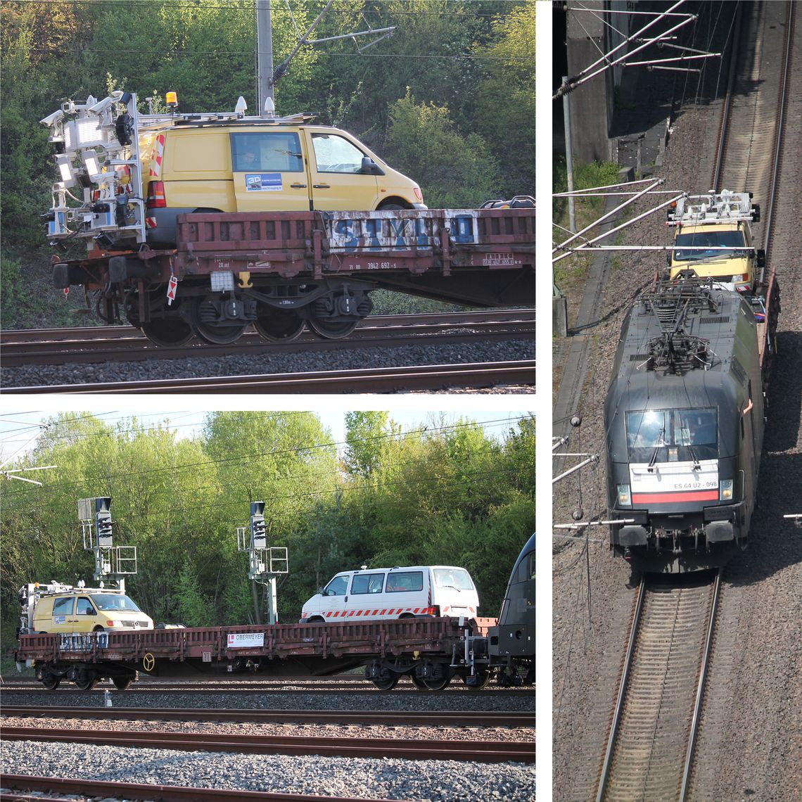
The Stuttgart-Mannheim high-speed line (from 1976) is to be completely renovated. This requires documentation of the actual state, which is usually done by time-consuming inspections of the rail track that are dangerous for the personnel. In order to simplify and accelerate the planning, to exclude the risk to people and to ensure the reproducibility of the results, 3D Mapping Solutions is commissioned to survey the track. On a flat car, our measuring vehicle measures the almost 99 km long route.
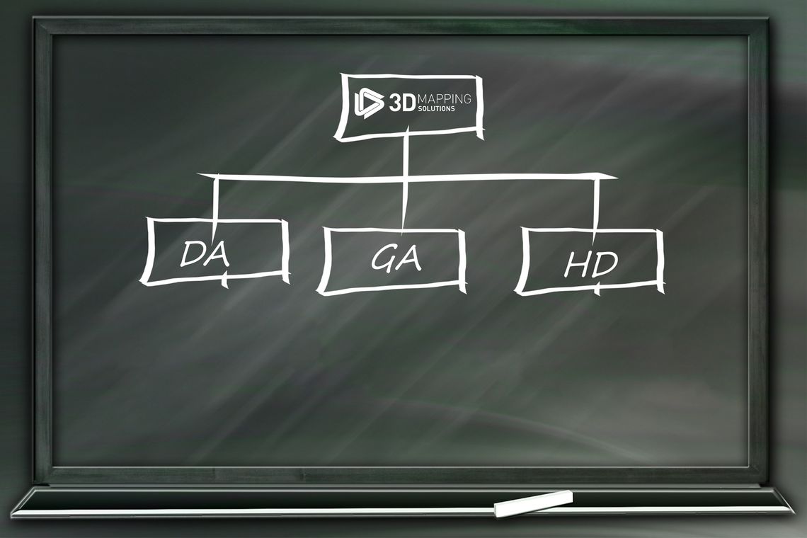
The growth of 3D Mapping Solutions, in terms of the number of employees (49) as well as the volume and quantity of orders, requires the restructuring of the company. In addition to the departments Data Acquisition, Geodetic Analytics and HD Maps, a management board is introduced. We develop into a successful medium-sized company. This is accompanied by a redesign of the complete external appearance of the company. A new logo is designed and the website is completely modernized.
3D Mapping Solutions conquers the American market: number and size of US customer orders necessitate the foundation of 3D Mapping Solutions Inc. We move into an office in Pittsburgh, hire the first local employees and set up a surveying vehicle permanently stationed in the USA.
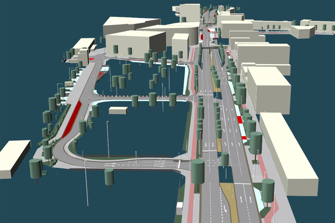
The use of digital twins of real routes in simulation and development is a megatrend. These lifelike virtual clones of road spaces are considered a key technology on the path to autonomous driving. They allow systems to be validated in less time compared to real-world tests. In 2018, 3D Mapping Solutions combines for the first time an OpenDRIVE® map, a surface model (OpenCRG®) and a 3D environment model to create a perfect digital twin of Wolfsburg‘s inner city area.
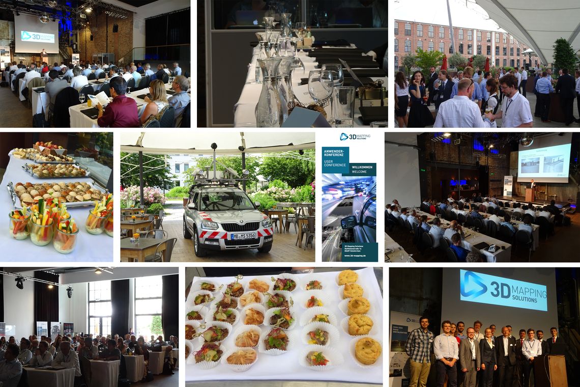
On the occasion of the 11th company anniversary, 3D Mapping Solutions invites national as well as international customers and partners to a large user meeting. The aim of the two-day conference is to bring together leading experts from the surveying and the automotive industries and to take a look into the future together across disciplines.
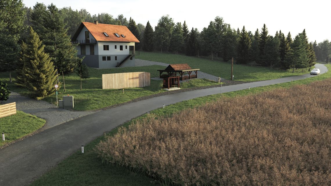
With the establishment of the HD VIZ department, 3D Mapping Solutions is for the first time able to offer the production of own, detailed 3D environment models. As the first commissioned pilot project, a nearly 1.2 km long country road east of Graz is implemented as a digital twin of a road map, surface model and 3D environment model in combination.
On the way to autonomous driving, the research project TEMPUS aims at realistic testing of automated and connected vehicles. As a project partner, 3D Mapping Solutions creates an HD map for the test field being built in the north of Munich. For this purpose, more than 250 kilometers of different road types are recorded and converted into estimated 3,800 roads and paths. More than 500 intersections, approx. 44,100 objects as well as approx. 10,800 signals complete the largest intelligent map of a contiguous inner city area to date.
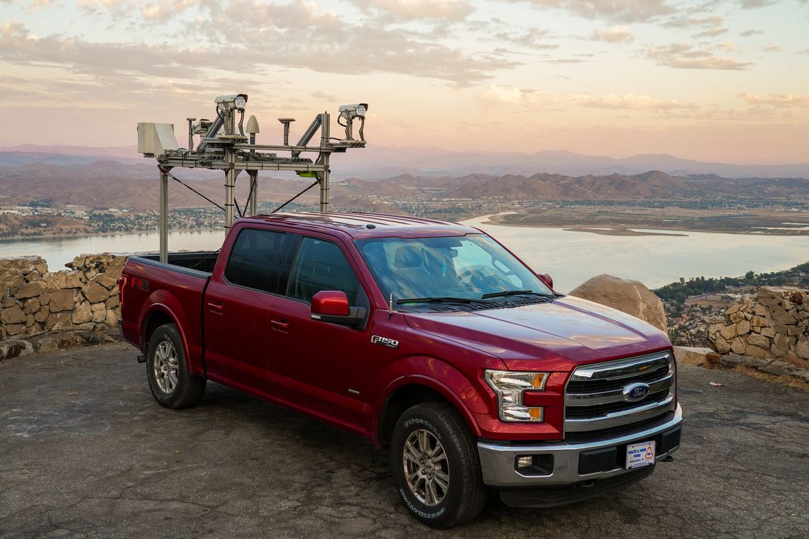
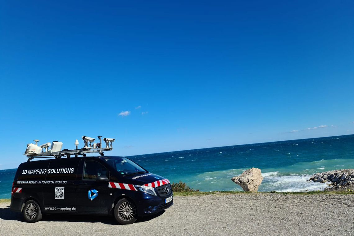
"Surveying the world" has begun. Five newly built vehicles supplement the fleet 3D Mapping Solutions starts with surveying motorway and road networks worldwide for a major client. We are starting in Europe with Germany, Norway, Finland, Sweden, Italy, France and Spain.
3D Mapping Solutions now offers another product in its portfolio: maps in Lanelet2 format. This format has been specifically developed for applications in the context of automated driving, in order to efficiently cope with the challenges a vehicle faces in complex traffic scenarios. Flexibility and extensibility are some of the core principles to meet the requirements of future maps. For this reason, customer requests for this new format are steadily increasing.
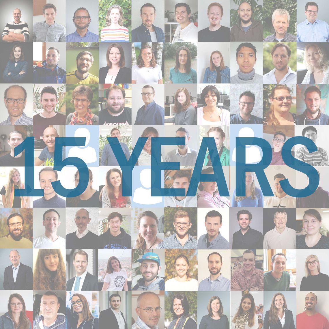
3D Mapping Solutions celebrates its 15th anniversary with meanwhile 80 employees and a fleet of eight surveying vehicles. Due to continuous growth, the workforce is currently spread over three locations within Holzkirchen. Also in the future we want to remain one of the leading providers of highly accurate surface models, intelligent HD maps and 3D environment models.